Skip to content
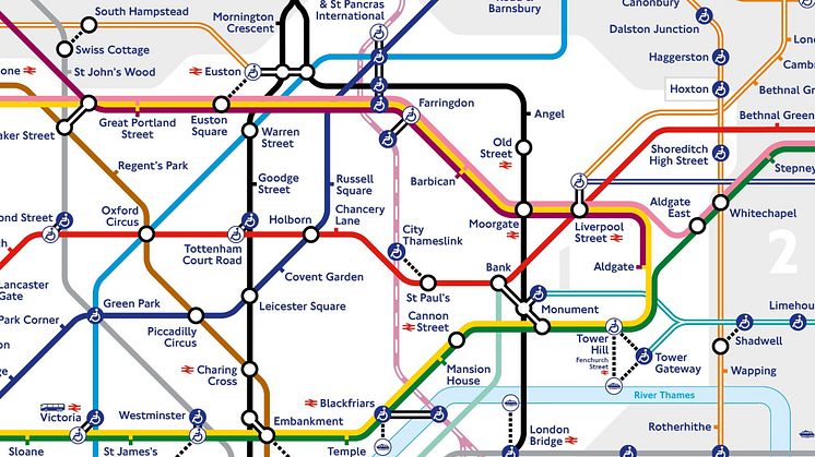
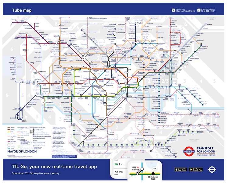
The new temporary Tube map shows Thameslink stations

Image -

The new temporary Tube map shows Thameslink stations

TfL
License:
Media Use
The content may be downloaded by journalists, bloggers, columnists, creators of public opinion, etc. It can be used and shared in different media channels to convey, narrate, and comment on your press releases, posts, or information, provided that the content is unmodified. The author or creator shall be attributed to the extent and in the manner required by good practice (this means, for example, that photographers should be attributed).
By:
TfL
File format:
.jpg
Size:
6786 x 5469, 4.57 MB
Download

Topics

Categories

Related content

Thameslink traverses the Tube map: supporting safe travel through central London

​Thameslink services set to be temporarily added to latest Tube map to help support customers during the coronavirus pandemic

Transport for London and Thameslink have issued the following press release:
Temporary addition from next month will illustrate more through-London travel options while customers need to maintain social distancing. Both TfL and Thameslink continue to ensure their services are as safe as possible, clean and reliable, while asking customers to plan ahead and travel during the quiet times.
Tr

Govia Thameslink Railway

United Kingdom