Skip to content
Drones save Balfour Beatty VINCI £5million on HS2 development

News -

Drones save Balfour Beatty VINCI £5million on HS2 development


Watch the DJI Enterprise case study here:

HS2 is the largest infrastructure project in Europe. The £106Bn development will create high-speed rail links between London, The Midlands and the North of England.

Joint venture Balfour Beatty VINCI (BBV) is designing and building the largest section of HS2's first phase - covering about 90km.

CHALLENGES

•Conducting regular and efficient surveys for progress updates and monitoring earthworks
•Staying on-budget and on-schedule, with Phase 1 due for completion between 2029 and 2033
•Keeping on-site personnel safe
•Traditional survey methods are potentially dangerous;

APPROACH

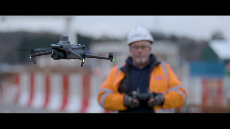
BBV has digitised the project - using drones to conduct faster, safer and more cost-effective surveys.

BBV has upgraded to the new Mavic 3 Enterprise - replacing the Phantom 4 RTK. The Mavic 3E has cut drone surveying times by 50% thanks to its longer battery life, larger sensor, and more rapid interval shooting rate. heliguy™ has supported BBV's adoption of the Mavic 3E, including survey-specific training.

RESULTS


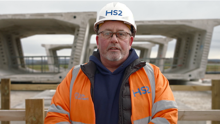
"Drones are a game-changer," admits Lee Johnson, Senior Survey Manager for BBV.

He continues: "Drones allow us to cover large areas very efficiently and we can survey far more safely from a remote position, removing people from potentially dangerous areas. By deploying drones on the HS2 development, the cost-savings will be substantial."

•Estimated £5million cost-savings over five years by deploying drones.
•10-20 minutes to measure a stockpile with a drone, compared to at least half-a-day using traditional methods.
•DJI Mavic 3 Enterprise halves drone surveying time compared to Phantom 4 RTK: Mapping 9.3km in a single 12-minute flight, compared to 29 minutes, over two flights, with the P4 RTK.
•Mavic 3 Enterprise's improved camera creates detailed, high-resolution digital assets.
•20-25mm survey-grade accuracy with Mavic 3 Enterprise, without GCPs.
•800 ‘working at risk days’ removed by deploying drones.
•Number of site visits reduced, cutting carbon emissions.
•Centralised data for remote monitoring, and improved collaboration/decision-making.

To Read the full case study, download video and photos, please click here: https://www.dropbox.com/sh/wnd...

Topics

Global leader in civil drone technology and aerial photography systems

Since 2006, DJI has led the world with civilian drone innovations that have empowered individuals to take flight for the first time, visionaries to turn their imagination into reality, and professionals to transform their work entirely. Today, DJI serves to build a better world by continuously promoting human advancement. With a solution-oriented mindset and genuine curiosity, DJI has expanded its ambitions into areas such as agriculture, public safety, surveying and mapping, and infrastructure inspection. In every application, DJI products deliver experiences that add value to lives around the world in more profound ways than ever before.

DJI Europe

DJI Europe
60327 Frankfurt
Germany

Visit our other newsrooms