New political map for Bury Council
Bury Council is set to have new boundaries for its council wards following a review by the Local Government Boundary Commission.
Bury Council is set to have new boundaries for its council wards following a review by the Local Government Boundary Commission.
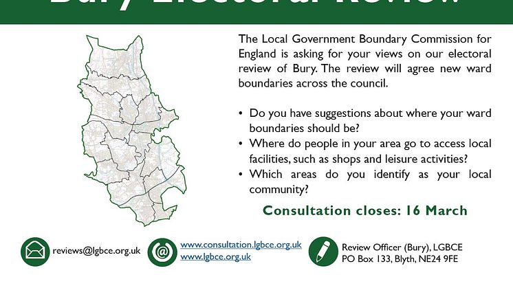
Residents have until Tuesday (16 March) to give their views on a new pattern of electoral wards which is being developed for Bury Council.
A new pattern of electoral wards is being developed for Bury Council, and residents are being invited to give their views.
Today (13 September) the independent Boundary Commission for England (BCE) has published its initial proposals for new Parliamentary constituencies. The publication marks the start of 12 weeks of consultation, during which the Commission needs to hear from you to help shape the proposed new constituency boundaries.
Bury Council consists of six towns, Bury, Ramsbottom, Tottington, Radcliffe, Whitefield and Prestwich. Formed in April 1974 as a result of Local Government re-organisation it was one of the ten original districts that formed the County of Greater Manchester. The Borough has an area of 9,919 hectares (24,511 acres) and serves a population of 187,500.

Knowsley Street
BL9 OSW Bury, Lancashire