Nyhet -
LoVe for the eddies
By Kanchana Bandara, Sünnje Basedow and Chathumini Kiel
On its surface, oceans are not just a uniform collection of water with waves on top. Although not seen by many eyes, the ocean is crisscrossed by many currents, such as the Gulf Stream – that carries heat over great distances. On the vertical dimension, the ocean is not uniform either! There are vertical layers with different temperature, salinity and density regimes caused by several processes, such as freshwater inputs from rivers and melting glaciers. When ocean currents flow over these layers of uneven densities and uneven seafloor features, instabilities can arise. Scientists call these ‘baroclinic instabilities’, which lead to the formation of ‘wrinkles’ in the ocean currents. As these ‘wrinkles’ grow, they eventually break off and become swirling eddies. Eddies are constantly moving and can be quite large, ranging from 10–100 km in diameter (hence called mesoscale eddies). These mesoscale eddies are a common occurrence in the Lofoten-Vesterålen (LoVe) region of the Norwegian Sea.
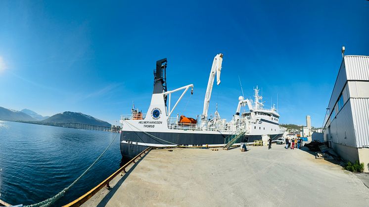
In the recent Migratory Crossroads research cruise, led by Professor Sünnje Basedow of UiT – The Arctic University of Norway, the team was constantly looking for mesoscale eddies. The research cruise, from May 29 to June 3, 2024, sampled coastal, shelf-break and offshore stations for hydrography (temperature, salinity, density), nutrients, phytoplankton, zooplankton and fish. Mesoscale eddies are of particular importance in this regard, as they can bring up nutrients from the greater depths to the surface, triggering phytoplankton blooms. These blooms are generally teeming with zooplankton, which in turn attract fish, creating localized hotspots of abundance. Further, circulation within mesoscale eddies can also trap phytoplankton and zooplankton while retaining them within a favorable environment for growth and reproduction. Some eddies exert a downward force on the planktonic organisms, thus carrying them to greater depths. This assists the seasonal downward migration of overwintering copepods, such as Calanus finmarchicus and accelerates the vertical transport (flux) of dissolved and particulate carbon from the surface waters to the ocean’s deep interior. This is called the ‘biological pump’, which is an important natural process that buffers the impacts of anthropogenic climate change.
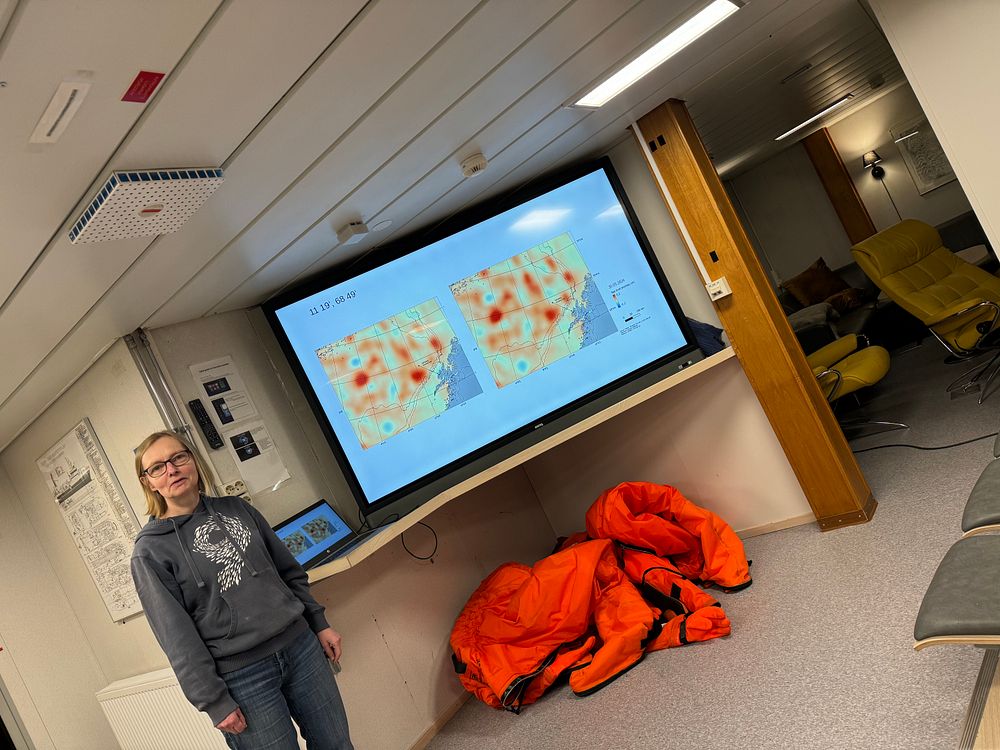
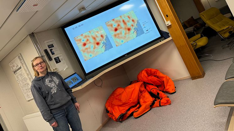
Cruise leader, Professor Sünnje Basedow (UiT). (Photo: Kanchana Bandara/Akvaplan-niva).
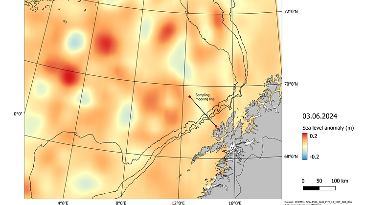
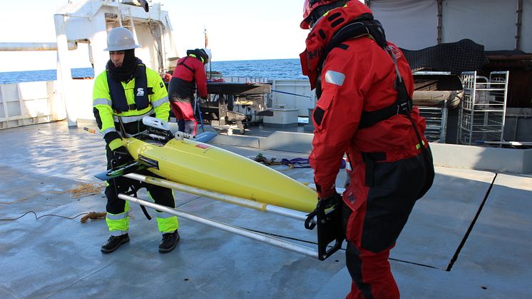
Eddies are not the easiest to spot while onboard a research vessel. Therefore, Sünnje and her team were focusing more on satellite remote sensing and in-situ water column profiling to detect eddies. Remote sensing detection is based on the subtle changes in sea surface height caused by the eddies. Usually, in the Northern Hemisphere, cyclonic upwelling (cold-core) eddies lead to ‘depressions’ and anti-cyclonic downwelling (warm-core) eddies lead to ‘raises’ on the sea surface. These local sea level changes can be detected by spaceborne radar altimeters, the data of which are analyzed as deviations from the mean sea level (sea level anomalies or SLA). In addition, a Moving Vessel Profiler (MVP) with integrated temperature and salinity sensors was towed behind the research vessel RV Helmer Hanssen (UiT) while profiling the water column. This also helps detect the mesoscale eddies because they often carry water with distinct temperature and salinity signatures compared to their surroundings.
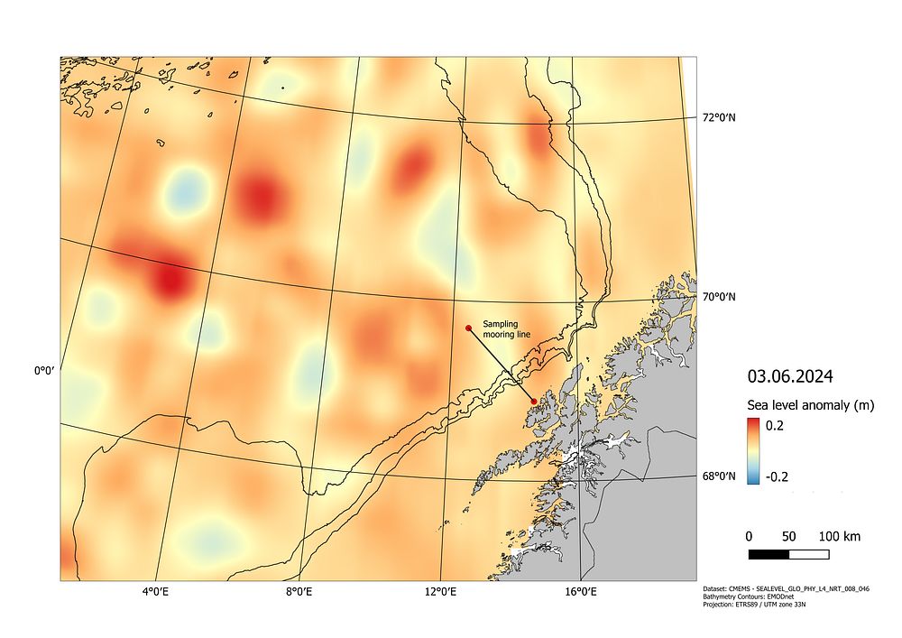
An Sea Level Anomaly (SLA) image (03.06.2024) showing ‘depressions’ (lighter colors) and ‘raises’ (darker colors) of the sea surface caused by cyclonic upwelling and anti-cyclonic downwelling eddies of the LoVe region. The sampling line along which plankton and fish were collected/observed is overlaid. (Image by André Valante, AIR Center, for the CliN-BluFeed project, led by Akvaplan-niva).
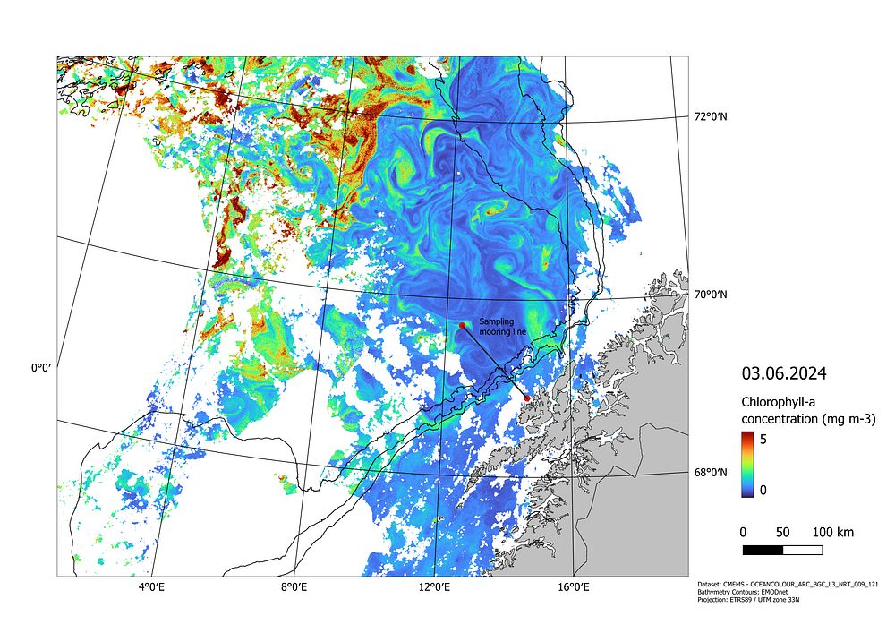
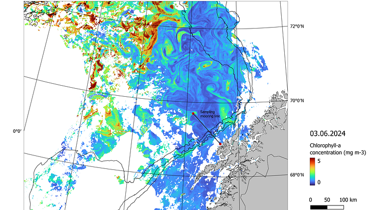
The corresponding near-surface Chlorophyll-a concentration estimated using the satellite images of ocean color (RGB) from Copernicus Sentinel-3 Ocean and Land Colour Instrument. (image courtesy of André Valante, AIR Center).
By combining these tools, Sünnje and her team aim to paint a comprehensive picture of eddy activity in the LoVe region. This information is crucial for understanding ocean circulation, nutrient transport, primary production and its trophic transfer along the LoVE marine food web. The next time you look at a satellite image or an ocean circulation model simulation of the Norwegian Sea, remember, that the swirling patterns might not just be currents – they could be eddies, hidden giants shaping the ocean’s mesmerizing story of biophysics.