Direkt zum Inhalt springen

Kategorien: gaf

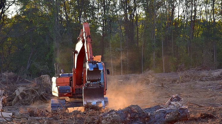
Deforestation activity ©pixabay bones64

ESA WorldAgrocommodities contract awarded to GAF AG and consortium

GAF AG, an e-GEOS (Telespazio/ASI) company, and a consortium of European partners (VITO, Wageningen University, GFZ, e-GEOS, Meridia, and Terrasphere) have been awarded the ESA WorldAgrocommodities contract following a tendering procedure. The project, with a duration of 24 months, focuses on the EUs Deforestation Free Supply Chain Regulation (EUDR), which will come into force in December 2024.

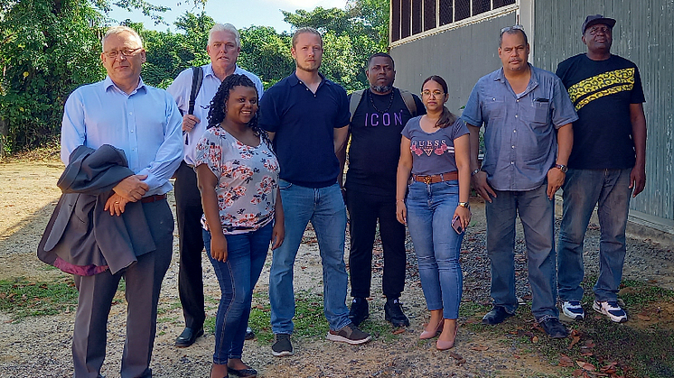
Client staff together with colleagues from the GAF consortium during the first project assessment mission. ©GAF AG

GAF AG awarded two contracts to assist the Suriname Ministry of Natural Resources

As part of the Suriname Competitiveness and Sector Diversification (SCSD) Programme being run by the World Bank, GAF AG, an e-GEOS (Telespazio/ASI) company, has been awarded the lead role in two consultancy contracts, with these being "International mining specialist to support the establishment and commissioning of the Minerals Institute of Suriname.

Kick-off Meeting of EU Consortium of the new Horizon Europe project EvoLand (Evolution of the Copernicus Land Service portfolio)  picture: GAF

New Horizon Europe project ‘EvoLand’ sets off to develop new prototype services for the Copernicus Land Monitoring Service

consortium under the lead of VITO officially launched the new Horizon Europe project EvoLand (Evolution of the Copernicus Land Service portfolio) in Leuven (Belgium) on the 17th and 18th of January 2023. EvoLand will develop and test new and innovative methods and algorithms and implement a bundle of candidate Copernicus Land Monitoring Service prototypes. GAF is a project partner.

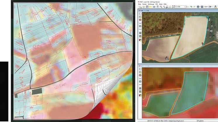
Auswertungstechnologien im Wandel der Zeit (©GAF AG)

30 Jahre Agrar-Fernerkundungskontrollen mit der GAF AG: Ende einer Ära und Beginn einer Neuen

Die GAF AG hat die fernerkundungsgestützte Kontrolle von Beihilfeanträgen im Rahmen der Europäischen Gemeinsamen Agrarpolitik (GAP) seit 30 Jahren mitgestaltet, durchgeführt und geprägt. Diese in ihrer Anwendungsbreite einzigartige Delegation öffentlicher Aufgaben an den Erdbeobachtungssektor findet nun ihre Ablösung in einem flächendeckenden und automatisierten Monitoringsystem, dem AMS.

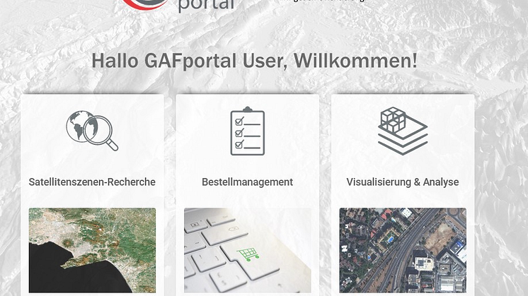
GAFportal: behördenübergreifende Bereitstellung sehr hochauflösender Satellitendaten über die Servicestelle Fernerkundung am Bundesamt für Kartographie und Geodäsie (BKG)

Kooperation GAF AG und BKG: Sehr hochauflösende Satellitendaten, Produkte und Dienste für mehr als 400 Bundesbehörden

in umfangreicher Rahmenvertrag erweitert die erfolgreiche Zusammenarbeit der GAF mit dem Bundesamt für Kartographie und Geodäsie (BKG Bund). Das von der GAF entwickelte hochmoderne Webportal wird auf der Open Telekom Cloud (OTC) ausfallsicher betrieben. Das GAFportal wird auf der Intergeo 22 auf dem Stand der GAF AG in Halle 2, Stand A2.006, präsentiert.

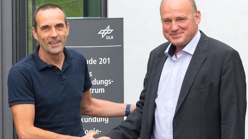
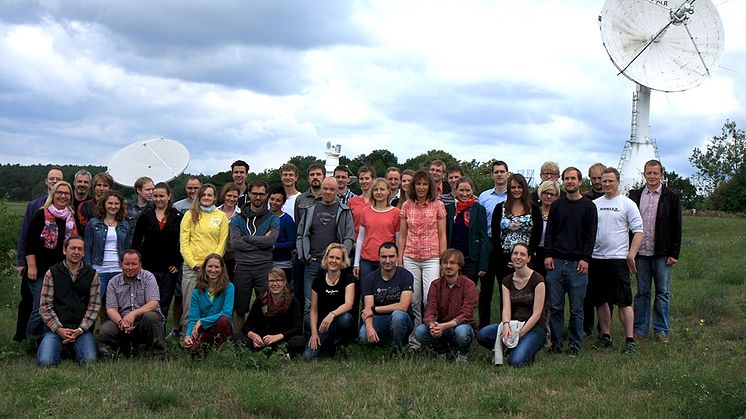
25 years of successful cooperation between GAF, DLR and Antrix Dr. Sebastian Carl (GAF) and Holger Maass (DLR) at the DLR campus Neustrelitz  (© GAF AG)

25 years of successful cooperation between GAF AG, DLR and Antrix

GAF, the German Aerospace Center (DLR) in Neustrelitz and Antrix Corporation have a successful cooperation stretching back 25 years. In 1996, they signed agreements for the purpose of receiving Indian Earth observation data and distributing the data to European customers on an exclusive basis. That was the starting point for 25 years of successful cooperation.

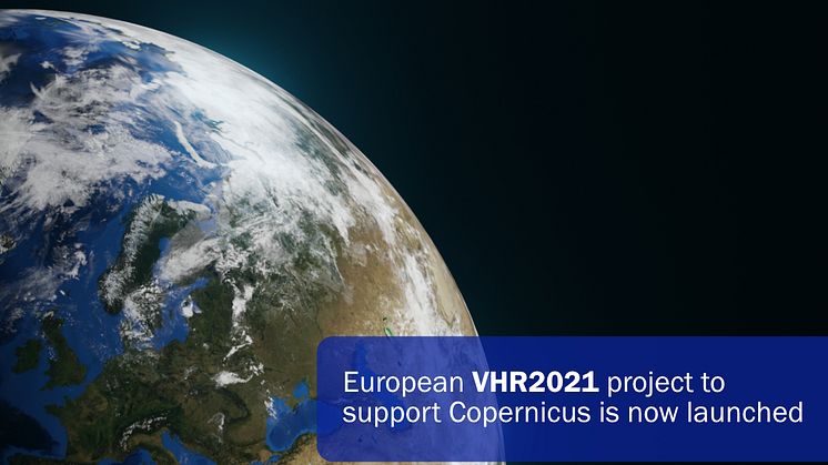
European VHR2021 project to support Copernicus is now launched

European VHR2021 project to support Copernicus is now launched

The Airbus-led consortium with GAF, selected by the European Commission and the European Space Agency (ESA), has started acquiring data to provide the Copernicus Earth Observation Programme with very high-resolution (VHR) satellite-based image coverage of Europe for 2021.

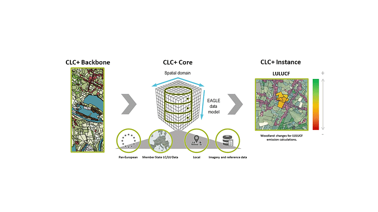
CLC+ Core database: Integrating various CLMS, ancillary and national LC/LU data into CLC+ Core to enable further derivation of CLC+ Instances, such as for LULUCF. Source: consortium (Cloudflight/GeoVille/GAF).

Empowering the new generation of European Land Cover and Land Use information: CLC+ Core to give a further boost to the Copernicus Land Monitoring Service

The next step towards implementing the new ground-breaking standard in Copernicus Land Monitoring has been initiated with the kick-off of the CLC+ Core initiative in December 2020. The Austrian–German consortium has been awarded a 3.1 million euro framework service contract by the European Environment Agency to implement and run the CLC+ Core system over the next four years.

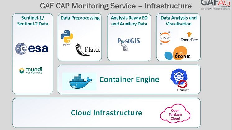
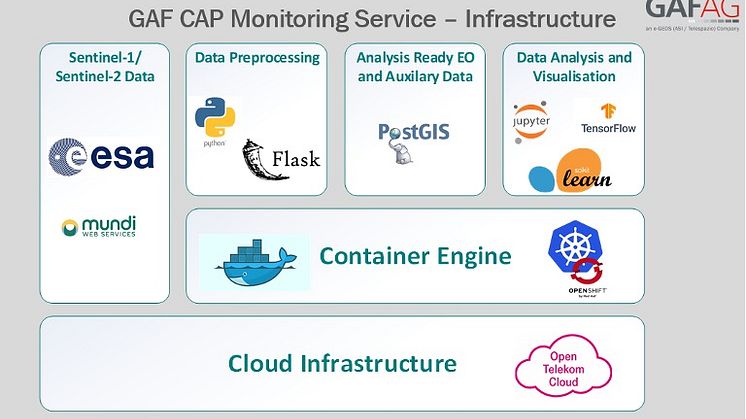
Infrastructure of GAF AG European CAP Monitoring   image: GAF AG

GAF HAS BEEN AWARDED A MULTI-YEAR CONTRACT BY THE GERMAN FEDERAL STATE OF SAXONY-ANHALT TO PERFORM CROP MONITORING IN THE CONTEXT OF THE EUROPEAN CAP

GAF AG has won the first European call for tenders for the operational implementation of the agricultural area monitoring system in Germany in 2021 stipulated by the European Common Agricultural Policy (CAP). The Paying Agency makes use of GAF’s sophisticated cloud-based solutions for the automatic monitoring of agricultural parcels.

Infrastruktur des Monitoring Services der GAF AG  Bild: GAF

GAF ERHÄLT MEHRJAHRESVERTRAG VON SACHSEN ANHALT

Sachsen-Anhalt hat einen Mehrjahresvertrag mit der GAF zur Durchführung des Monitorings landwirtschaftlicher Flächen im Rahmen der Gemeinsamen Agrarpolitik (GAP) in der EU abgeschlossen.

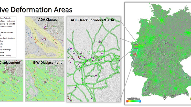
Legacy project: German Ground Motion Service (BodenBewegungsdienst Deutschland - BBD) enabling various downstream applications (ref.: BGR 2020)  image: GAF

A consortium with strong GAF contribution has been awarded the implementation of the latest European Copernicus service for the monitoring of ground motion

A consortium with strong GAF contribution has been awarded the implementation of the latest European Copernicus service for the monitoring of ground motion. . The new European Ground Motion Service (EGMS) will enable monitoring of millimeter-range ground motion through time series of satellite based radar observations. e-GEOS will lead the consortium.

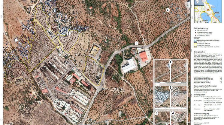
Delineation and grading map for the fire in the refugee camp of Moria  (c) Bundesamt für Kartographie und Geodäsie

GAF AG and BKG intensify their cooperation regarding the provision of multi-source remote sensing data

GAF AG and BKG intensify their cooperation regarding the provision of multi-source remote sensing data GAF AG, one of the largest European providers of geographic information services with a focus on earth observation, has won an international tendering process issued by the German Federal Agency for Cartography and Geodesy (BKG) for the provision of remote sensing data.

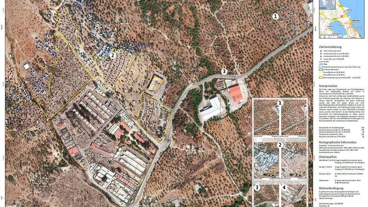
Lage- und Detailkarte für den Brand im Flüchtlingslager Moria, September 2020    (c) Bundesamt für Kartographie und Geodäsie)

GAF AG und BKG intensivieren ihre Kooperation im Hinblick auf die Bereitstellung von Multi-Source-Fernerkundungsdaten

GAF AG und BKG intensivieren ihre Kooperation im Hinblick auf die Bereitstellung von Multi-Source-Fernerkundungsdaten Die GAF AG, einer der größten europäischen Anbieter von Geoinformationsdiensten mit dem Schwerpunkt Erdbeobachtung, hat eine internationale Ausschreibung des Bundesamts für Kartographie und Geodäsie (BKG) für die Bereitstellung von Fernerkundungsdaten gewonnen. D

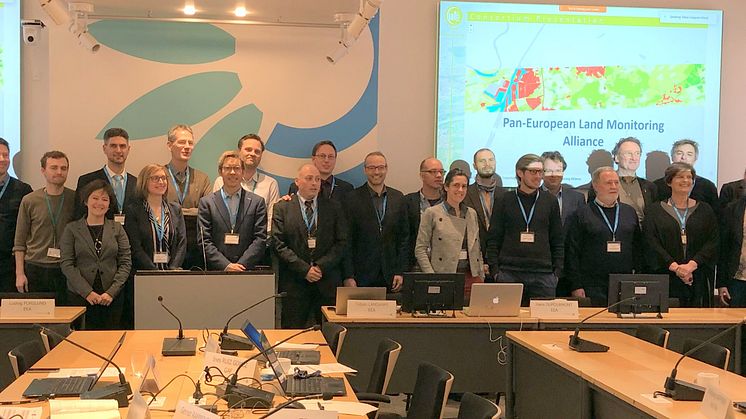
CLC+ Backbone consortium together with EEA, EAGLE and ETC ULS teams  (photo: M. Probeck, GAF)

​The new European standard in Copernicus Land Monitoring for the coming decade: CLC+ Backbone has been kicked off

A European consortium of 14 companies and research institutions from 11 EEA member countries under the lead of GAF (Germany) has been awarded a 10 million € framework contract for implementing the CLC+ Backbone, the new ground-breaking standard in Copernicus Land Monitoring. This unique product will constitute a key element in monitoring the European Green Deal and strengthen Europe’s position as

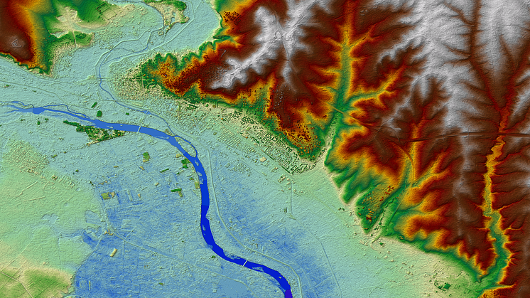
Euro-Maps 3D DSM of Edirne and the river Maritsa, Greek-Turkish border region. © 2017 GAF AG. Includes material © Antrix, distributed by GAF AG.

​Euro-Maps 3D DSM now also available via the Copernicus Data Access Portfolio


ESA, the European Space Agency, has added the Euro-Maps 3D DSM (digital surface model) product with 5 m post spacing to the Copernicus Data Access Portfolio (DAP) (see latest DAP document, Annex 6), thus making it available to Copernicus Services, Union Institutions and Union Research Projects through the Copernicus Data Warehouse (DWH). Euro-Maps 3D DSM provides a homogeneous quality,

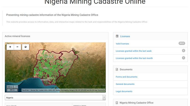
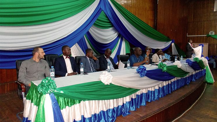
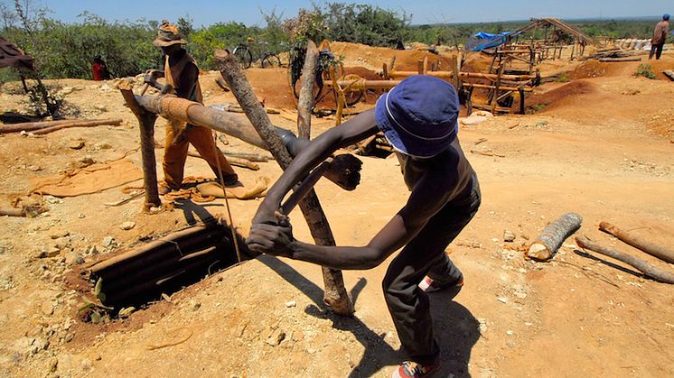
​Gabon mining sector project awarded to GAF AG

​Gabon mining sector project awarded to GAF AG

GAF AG, Germany and its partner Sofreco, France, are pleased to announce the awarding of the “Renforcement des Capacités de l’ Administration des Mines" contract andthe initiation of activities in Gabon.

Mehr anzeigen

Aigner Marketing - Technologiemarketing seit 1998

Die Aigner Marketing GmbH ist eine inhabergeführte full service Agentur - mit internationaler Reichweite und absolutem Engagement für Kunden jeder Größenordnung. Eine unserer Stärken ist das schnelle Erfassen und Verständnis von komplexen, erklärungsbedürftigen Produkten und die Fähigkeit, dies in Wort und Bild attraktiv und verständlich zu kommunizieren. Deshalb liegt unser Schwerpunkt im Bereich Technologie und B2B, mit einem Fokus auf Public Relations. Neben einer fundierten Beratung bieten wir sämtliche strategischen, konzeptionellen, kreativen und technischen Leistungen, die für die Entwicklung und Umsetzung erfolgreicher Kommunikation entscheidend sind. Wir begleiten unsere Kunden mit hoher fachlicher Expertise, erstklassigen Dienstleistungen und persönlichem Engagement. Unser Anspruch ist das optimale Ergebnis - unser langjähriger Kundenkreis ist überzeugt davon und profitiert von der Zusammenarbeit mit uns. Wir verfügen über ausgezeichnete Referenzen und Know-how in unterschiedlichsten technologischen Branchen und Bereichen sowie über ein sehr gut gepflegtes Netzwerk von Pressekontakten.

Aigner Marketing GmbH

Rumfordstraße 29
80469 München
Germany